
Bengaluru: The India Meteorological Department (IMD) has announced the early arrival of the southwest monsoon, which made landfall in Kerala and parts of Karnataka on Saturday—almost a week ahead of the usual onset date of June 1.
The monsoon has already spread over Coastal Karnataka and some areas of South Interior Karnataka. The IMD noted that the northern boundary of the monsoon now passes through Karwar, Shivamogga, Hassan, and Mysuru in Karnataka, as well as Dharmapuri and Chennai in Tamil Nadu.
Meteorologists believe that the prevailing conditions will support the monsoon's continued progress into more parts of Karnataka over the next few days.
According to forecasts, Karnataka is expected to witness widespread rainfall through May 30. Coastal regions may experience heavy to extremely heavy showers, while interior districts like Kodagu, Hassan, Shivamogga, and Chikkamagaluru are likely to receive heavy to very heavy rain. Districts such as Bagalkot, Koppal, Gadag, and Vijayapura may see isolated storms accompanied by strong winds reaching 40–50 km/h in the coming 48 hours.
Cloudy and Wet Conditions in Bengaluru
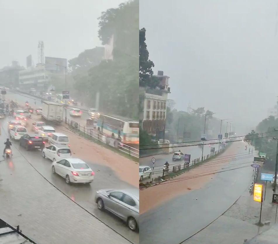
Bengaluru is expected to remain mostly cloudy until May 26, with moderate rain and thunderstorms accompanied by gusty winds of 40–50 km/h. Daytime temperatures are expected to hover around 27°C, while nighttime lows may settle near 21°C.
Rainfall in Bengaluru has already surpassed average seasonal levels. Since March 1, the city observatory has recorded 343 mm of rain, compared to the usual 205 mm for this period. HAL airport has received 365 mm, well above its typical 235 mm, while Kempegowda International Airport has recorded 289 mm so far this season.